Khadir Fm
Type Locality and Naming
Local: Type section is exposed at Cheriybet on the north of Kakinida bet near Gadhada (Biswas, 1971)
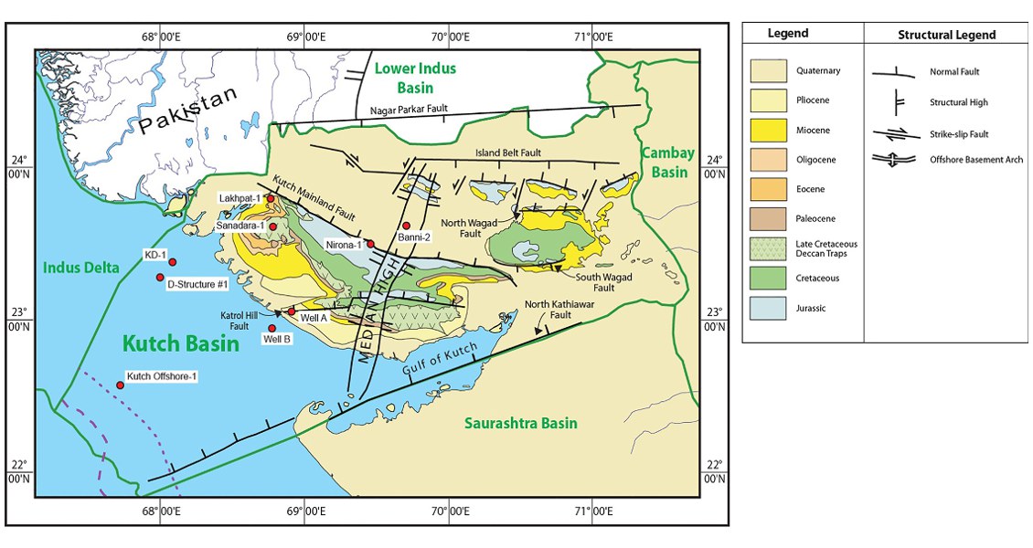
[Fig. Geological and structural map of Kutch, also showing the onshore and offshore wells drilled for oil exploration. (Map by Rasoul Sorkhabi in GeoExpro Dec2014, based on various sources including S.K. Biswas, Current Science, 25May2005)]
Lithology and Thickness
Formation is consisting of shale, limestone (occasionally oolitic), chert nodules with thick overlying sandstone and thin sandstone in the middle part; subordinate sandstone in upper part. Thick marine sandstone, fossiliferous shale, calcareous sandstone, coquina limestone in the basal part. Granite cobbles conglomerate presents towards the bottom. In the type area, it is +500 m
Relationships and Distribution
Lower contact
Not exposed
Upper contact
Top of formation is marked by the beginning of overlying non-marine rocks of the Wagad Sandstone Fm above a thin fossiliferous conglomerate band near Gedi in north Wagad.
GeoJSON
Fossils
Pelecypods and Gastropods
Age
Depositional setting
Piedmont, littoral to sub littoral (Transgression)
Additional Information
